Distance Calculator

Arlberg Schnellstraße, Inntal Autobahn

189.4 km, 2 h 22 min

Head west150 m
Continue onto Vorachstraße100 m
Turn left to stay on Vorachstraße600 m
Turn right onto Sägerstraße800 m
Enter the traffic circle and take the 3rd exit towards L204: Innsbruck60 m
Exit the traffic circle towards L204: Innsbruck1.5 km
Continue onto Lustenauerstraße (L204)1 km
Enter Lustenauerstraße and take the 2nd exit towards A 14: Innsbruck55 m
Exit the traffic circle towards A 14: Innsbruck250 m
Merge left towards Hohenems45 km
Continue onto Arlberg Schnellstraße (S16)25 km
Continue onto Arlbergtunnel (S16)15 km
Continue onto Arlberg Schnellstraße (S16)450 m
Continue onto Schnauer Galerie (S16)300 m
Continue onto Arlberg Schnellstraße (S16)5.5 km
Continue onto Mittlere Riefe Galerie (S16)250 m
Continue onto Hohe Riefe Galerie (S16)400 m
Continue onto Arlberg Schnellstraße (S16)250 m
Continue onto Tunnel Flirsch (S16)1 km
Continue onto Tunnel Gondebach (S16)500 m
Continue onto Arlberg Schnellstraße (S16)7 km
Continue onto Tunnel Pians/Quadratsch (S16)1.5 km
Continue onto Arlberg Schnellstraße (S16)1.5 km
Continue onto Sannabrücke (S16)150 m
Continue onto Perjentunnel (S16)3 km
Continue onto Arlberg Schnellstraße (S16)2 km
Continue onto Inntal Autobahn (A12)70 km
Keep left onto Inntal Autobahn (A12)9 km
Take the ramp towards Hall Mitte500 m
Enter the traffic circle and take the 2nd exit towards B171a: Hall in Tirol40 m
Exit the traffic circle towards B171a: Hall in Tirol1 km
Turn left onto B171a450 m
Continue onto Stadtgraben (L8)150 m
Turn left onto Fassergasse150 m
Turn right onto Schweygerstraße200 m
Turn left onto Recheisstraße100 m
Turn left25 m
Turn right55 m
You have arrived at your destination, on the right0 m
From
    To

      Distance: 86.18 mi (138.69 km)

      Driving route: 117.70 mi (189.41 km).

      Driving time: 2h 21 min

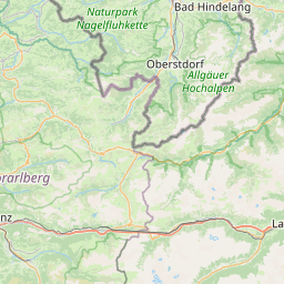
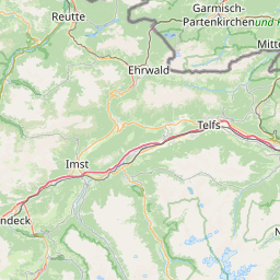
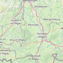
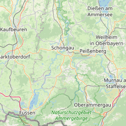
      Distance from Lustenau to Hall in Tirol

      The shortest distance (air line) between Lustenau and Hall in Tirol is 86.18mi (138.69 km)

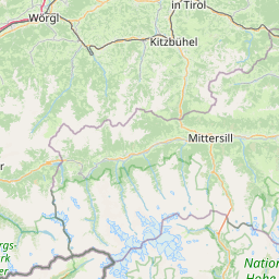
      The shortest route between Lustenau and Hall in Tirol is 117.70 mi (189.41 km) according to the route planner. The driving time is approx. 2 h 21 m

      How far is it between Lustenau and Hall in Tirol.

      Lustenau is located in Rheintal-Bodenseegebiet, Austriacountry within 47° 25' 37.56" N 9° 40' 15.96" E (47.4271, 9.6711) coordinates. The local time in Lustenau is 23:57 (17.03.2025)

      Hall in Tirol is located in Innsbruck, Austriacountry within 47° 16' 59.88" N 11° 30' 0" E (47.2833, 11.5000) coordinates. The local time in Hall in Tirol is 23:57 (17.03.2025)

      The calculated flying distance from Lustenau to Hall in Tirol is 86.18miles which is equal to 138.69 km.

      If you want to go by car, the driving driving distance between Lustenau and Hall in Tirol is 117.70 miles (189.41 km). If you ride your car with an average speef of 112 kilometers/hour (70 miles/h), travel time will be 1 hours 41 minutes.Please check the avg.speed travel time on the right for various options

      Estimated Travel Time Between Lustenau and Hall in Tirol

      Average speedTravel Time
      30 mph (48 km/h)3 hours 55 minutes
      40 mph (64 km/h)2 hours 57 minutes
      50 mph (80 km/h)2 hours 21 minutes
      60 mph (67 km/h)1 hours 58 minutes
      70 mph (112 km/h)1 hours 41 minutes
      75 mph (120 km/h)1 hours 34 minutes

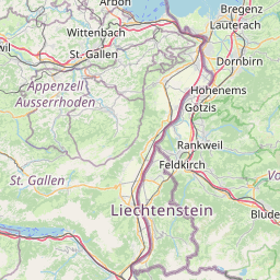
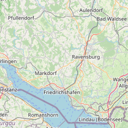
      Lustenau, Rheintal-Bodenseegebiet, Austria

      Related Distances from Lustenau

      CitiesDistance
      Lustenau to Dornbirn3.76 mi (6.05 km)
      Lustenau to Bregenz6.50 mi (10.46 km)
      Lustenau to Innsbruck81.36 mi (130.94 km)
      Lustenau to Hall in Tirol86.18 mi (138.69 km)
      Lustenau to Salzburg159.23 mi (256.26 km)
      Lustenau to Villach203.86 mi (328.08 km)
      Lustenau to Wels207.79 mi (334.40 km)
      Lustenau to Traun218.89 mi (352.28 km)
      Lustenau to Leonding220.39 mi (354.69 km)
      Lustenau to Linz222.34 mi (357.82 km)
      Lustenau to Steyr224.45 mi (361.22 km)
      Lustenau to Klagenfurt225.07 mi (362.21 km)
      Lustenau to Amstetten245.87 mi (395.70 km)
      Lustenau to Wolfsberg246.28 mi (396.35 km)
      Lustenau to Leoben253.71 mi (408.31 km)
      Lustenau to Kapfenberg262.53 mi (422.51 km)
      Lustenau to Graz271.56 mi (437.03 km)
      Lustenau to Sankt Polten280.92 mi (452.09 km)
      Lustenau to Krems an der Donau283.58 mi (456.37 km)
      Lustenau to Wiener Neustadt307.47 mi (494.82 km)
      Lustenau to Baden307.62 mi (495.07 km)
      Lustenau to Modling310.38 mi (499.51 km)
      Lustenau to Klosterneuburg313.84 mi (505.08 km)
      Lustenau to Vienna315.46 mi (507.68 km)
      Lustenau to Eisenstadt319.93 mi (514.88 km)

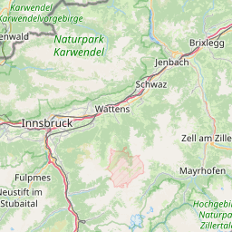
      Hall in Tirol, Innsbruck, Austria

      Related Distances to Hall in Tirol

      CitiesDistance
      Innsbruck to Hall in Tirol5.11 mi (8.22 km)
      Salzburg to Hall in Tirol80.42 mi (129.42 km)
      Dornbirn to Hall in Tirol82.44 mi (132.67 km)
      Bregenz to Hall in Tirol83.31 mi (134.07 km)
      Lustenau to Hall in Tirol86.18 mi (138.69 km)
      Villach to Hall in Tirol119.29 mi (191.99 km)
      Wels to Hall in Tirol131.42 mi (211.50 km)
      Klagenfurt to Hall in Tirol139.85 mi (225.07 km)
      Traun to Hall in Tirol142.82 mi (229.85 km)
      Leonding to Hall in Tirol145.14 mi (233.58 km)
      Steyr to Hall in Tirol145.28 mi (233.81 km)
      Linz to Hall in Tirol147.36 mi (237.15 km)
      Wolfsberg to Hall in Tirol160.16 mi (257.75 km)
      Amstetten to Hall in Tirol166.79 mi (268.42 km)
      Leoben to Hall in Tirol168.57 mi (271.29 km)
      Kapfenberg to Hall in Tirol177.66 mi (285.92 km)
      Graz to Hall in Tirol185.54 mi (298.60 km)
      Sankt Polten to Hall in Tirol201.46 mi (324.22 km)
      Krems an der Donau to Hall in Tirol206.28 mi (331.98 km)
      Wiener Neustadt to Hall in Tirol224.52 mi (361.33 km)
      Baden to Hall in Tirol225.95 mi (363.63 km)
      Modling to Hall in Tirol229.24 mi (368.93 km)
      Klosterneuburg to Hall in Tirol234.39 mi (377.22 km)
      Vienna to Hall in Tirol235.18 mi (378.48 km)
      Eisenstadt to Hall in Tirol237.09 mi (381.55 km)